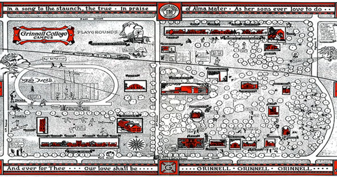
1949 Campus Map
College campuses are always changing and evolving as the needs of students and faculty shift, and nowhere is this more true than here at Grinnell. The Grinnell College campus of today looks very different than the campus of the past. This can best be seen by examining the campus maps housed in Special Collections and Archives.
Maps offer a helpful glimpse into the past of the College by showing what buildings existed and where they were located. Utilizing maps allows patrons to track changes to campus over time. For example, in maps created before the late 1960s, it is easy to see the separation of men and woman on campus through the existence of the Men’s Dorms on north campus, and the Women’s Quadrangle on south campus. Special Collections houses a variety of maps, from ones that show the campus of the past, to ones of future plans that were never utilized.
This particular map dates from 1949. Although not strictly accurate in terms of scale, it does include almost all buildings and fields that were present on campus at the time. The exceptions seem to be the stables and the golf course. If current Grinnell students were able to travel back in time, they would hardly recognize portions of the campus as it existed in 1949. Unfamiliar sights would include Darby Gym and the Women’s Gym, the Union, Music Hall, Blair Hall, Magoun Hall, and Veteran’s Housing. Absent would be important locations on campus such as Burling Library, the Bucksbaum Center for the Arts, the Joe Rosenfield ’25 Center, the Robert N. Noyce ’49 Science Center, and the Charles Benson Bear ’39 Recreation and Athletic Center.
The map features a level of decoration not usually seen on renderings of campus. Around the edges are written lyrics to “The Sons of Old Grinnell” as well as coats of arms for six of the buildings on campus. Small stick drawings show students around campus engaging in a variety of activities, from fencing and archery, to running to make it to class on time. Also included on this map is the placement of trees which is unusual for a map that’s purpose did not include campus planning.
We encourage anyone with an interest to drop by Special Collections and look at our extensive map collection in person. Special Collections and Archives is open to the public 1:30-5 p.m. Monday through Friday and mornings by appointment.