Old Maps, New Technology
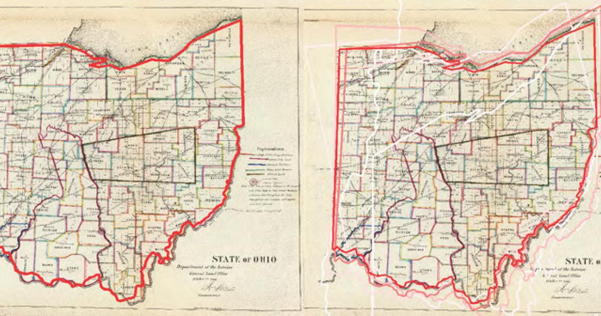
Old maps are rich sources of historical information, but manually cataloging the information on them is time-consuming and costly.
Jerod Weinman, associate professor of computer science, and his co-researchers have plans to make them “searchable the way scanned books have become accessible to web search.”
With a National Science Foundation grant, he and Erik Learned-Miller, University of Massachusetts Amherst, have set themselves and their students a lofty goal — helping others search and analyze historical maps by automatically recognizing place names and other text, and aligning them with modern geography.
The National Science Foundation awarded the computer science professors nearly half a million dollars in a three-year grant for their project, Adaptive Integration of Textual and Geospatial Information for Mining Massive Map Collections.
Grinnell’s share will support up to 14 student researchers who’ll work with Weinman on the project.
Drawing Information From Old Maps
“Libraries and archives are digitizing historical maps for widespread online access. Without technology for searching them, large map collections relevant to a given problem or question may remain obscure even in online archives,” Weinman and Learned-Miller say. “If all of the text in a map can be read automatically by computer, a wealth of information becomes quickly available — location names, geographic features, and often statistics.”
The group is developing techniques that will — working back and forth between old maps and a world atlas — make text and geographical information available to researchers.
This information can help in a variety of ways. For example, scientists and policymakers can establish changes in land usage, waterways, or borders over time.
“Right now we’re targeting pre-digital era 19th century maps because they represent geography with reasonable accuracy while still being typeset by hand or handwritten,” Weinman says.
Why at Grinnell?
The hands-on research experience, say the professors, will “train a diverse group of graduate and undergraduate students in constructing, learning, and making predictions with adaptive models.”
Many of the Grinnell students working on the project will be doing so through Mentored Advanced Projects (MAP). Weinman’s approach to mentored projects emphasizes “not only scientific methodology, but also the philosophy of computing as a science.”
He and fellow researchers — including David Lopatto, professor of psychology and director of the Center for Teaching, Learning and Assessment, and David Jensen, director of Knowledge Discovery Laboratory at University of Massachusetts Amherst — have shown that computer science students report more benefits from their research experiences using this method than they would with methods that are more traditional.
The researchers will share their findings through journals and conferences in the computer vision, artificial intelligence, and GIS communities.