With Photosphere, You are (Almost) There
Have cellphone, will travel: that’s the mantra in today’s device-driven world. Now, with a smartphone camera and a special app, a new project is providing virtual tours of archaeological sites in northern Arizona.
The Kaibab National Forest’s website now displays amazing 360-degree views of actual pueblos and rock art sites, old cabins and fire lookouts, and historic railroads, trails, and roads.
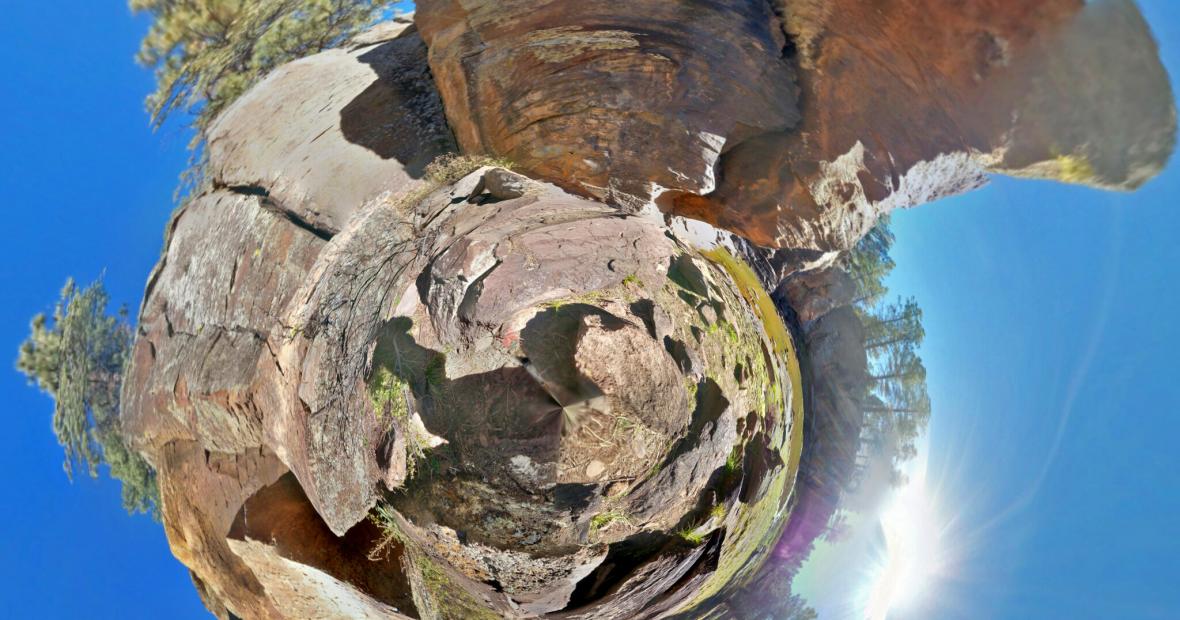
Using Google Camera on a phone, archaeologist Neil Weintraub [’86] snaps a picture at a site — or actually 41 images stitched together, to form a collage called a “photosphere.” On screen, users can rotate the view and gain a sense of the entire surrounding landscape. When that image is downloaded into the Tiny Planets app, a compressed and more artistic rendering can be created.
Neil feels this technique will provide an unusual perception on archaeological and historical sites. It provides for him additional clues as to why people built pueblos where they did many years ago. Also the near three-dimensional pictures show how significant the sky and landscape was to people who resided in the region many years ago.
While it is not the same as being there in person, Weintraub is confident that this method will provide people a preview, so that when or if they do visit it in person, they will see it from a new perspective.
Originally appeared in KNAU Earth Notes. Republished with permission.